

India is currently in the middle of its summer monsoon, but this year’s rainfall presents an interesting paradox. Much of the country has received less rain than usual so far, yet has still been hit by severe floods and landslides. In the southern state of Kerala, for example, devastating floods occurred despite the overall monsoon rainfall remaining well below average.
A weaker monsoon does not necessarily mean an absence of extreme rainfall. Rainfall can be highly uneven, with long dry spells broken by intense cloudbursts that cause flooding and landslides. This year’s experience in Kerala illustrates the apparent contradiction: a season that is dry overall can still produce devastating rainfall.
Amid this highly uneven monsoon, attention is also turning to something happening thousands of kilometres away in the tropical Pacific Ocean: El Niño.
It is well established that El Niño years, when certain parts of the Pacific are warmer than usual, are often associated with weaker Indian monsoon rainfall. Meanwhile La Niña – the opposite state to El Niño – tends to favour wetter conditions. This year, El Niño conditions have developed rapidly in the Pacific, with forecasts suggesting it could become exceptionally strong.
A super-strong El Niño could have important implications for hundreds of millions of people across India, particularly later in the monsoon, when the relationship between the two tends to become stronger.
An uneven monsoon
Before the monsoon even began, the India Meteorological Department was already expecting a weaker-than-usual season, partly because of the anticipated development of El Niño. Its first long-range forecast in April predicted June-September rainfall at around 92% of the long-term average. So far, rainfall has broadly followed this below-normal outlook, although with considerable fluctuations. By mid-June, rainfall across India was nearly 40% below normal, before several active monsoon spells reduced the deficit. By early August, cumulative rainfall was still around 12% below average nationally.
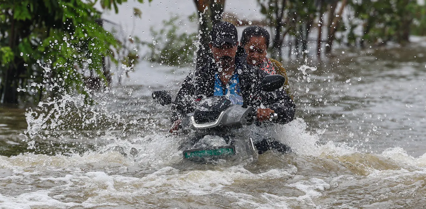
But these national and seasonal averages hide an important part of the picture. Take Kerala. Between June 1 and August 5 2026, the state received around 22% less rainfall than normal. Yet during the single week from July 30 to August 5, the state received more than double its usual rainfall.
Lijo Abraham Joseph
This intense spell of rain triggered severe flooding and landslides, despite the state still being rainfall-deficient when viewed over the season as a whole. By August 5, 26 people had died in monsoon-related incidents across Kerala. Among them were a mother and son who were killed when a landslide buried their home in Poonjar, Kottayam – a tragedy that felt especially close to home because my aunt knew the family.
But the relationship is more complicated than simply saying that El Niño causes drought over India. El Niño is one of the most important large-scale phenomena that influences the Indian monsoon, but it does not determine the season on its own. Of the 16 El Niño years recorded since 1950, only seven were associated with below-normal monsoon rainfall over India. Other factors play a role, including the Indian Ocean temperatures and wind patterns, snow cover in the Himalayas and Eurasia, along with the monsoon’s own natural variability from year to year.
More importantly, a weaker monsoon does not necessarily mean an absence of extreme rainfall or floods. A study published in Science in 2025, analysing more than a century of rainfall observations, found that El Niño summers can produce lower rainfall overall while simultaneously intensifying extreme daily rainfall, particularly over parts of central-eastern India and the southwest coast (where Kerala is located). In other words, El Niño can potentially create an apparently contradictory situation: less rain over the season as a whole, but heavier rain when it does rain.

Ligin Joseph (Data: IMD)
The recent experience in Kerala – a seasonal rainfall deficit interrupted by an exceptionally wet week and severe flooding – is consistent with this broader pattern, although the individual flood itself cannot be attributed to El Niño without a dedicated analysis.
What happens next?
There is certainly reason to keep a close watch on the Pacific. El Niño is already strengthening rapidly, and is expected to be very strong throughout the northern hemisphere autumn and winter of 2026-27.
However, this does not mean that India is destined for drought. An El Niño of this magnitude increases the likelihood of drought, flooding and other typical impacts, but they are not guaranteed.
This El Niño is expected to peak after the core summer monsoon season, but it is already strengthening while the monsoon is still underway. For India, the important question isn’t how much rain will fall in total, but where, when and how intensely it will fall.
The post “A ‘super El Niño’ could make India’s monsoon drier yet more dangerous” by Ligin Joseph, PhD Candidate, Oceanography, University of Southampton was published on 08/25/2026 by theconversation.com