All sea turtle species are threatened worldwide. They migrate long distances in the oceans – often thousands of kilometres – and so fall under multiple countries’ laws and conservation targets. They also have a complex life cycle with changes in habitats and diet at different life stages. These things make it difficult to protect them from threats like illegal harvesting, fisheries bycatch, coastal development, diseases and pollution.
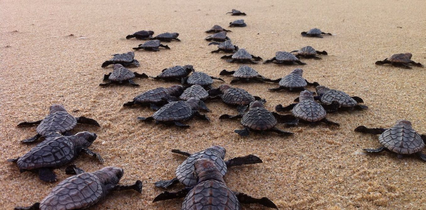
Although they predictably return to the same nesting grounds on beaches where they were born, and the movements of adults have been well studied (mostly using satellite tracking), very little is known about their early life. Once newly hatched turtles enter the sea and disperse, they are gone for several years, also known as the “lost years”.
Diane le Gouvello, Author provided (no reuse)
It’s hard to track hatchlings because they are small (just a few centimetres long), many die, and the survivors grow fast (so tracking devices don’t stay on). But knowing more about where they go during these “lost years” would help conservation scientists to improve their chances of survival and thus ensure recruitment and population viability.
Computer models are valuable tools for predicting the distribution of organisms in the oceans. The Sea Turtle Active Movement Model, for example, has been used to suggest how young turtles might disperse in the North Pacific and North Atlantic oceans – not only drifting in currents but actively swimming to their preferred habitats. The two most important factors are water temperature and food availability.
Read more:
Seychelles: floating baby corals can help save damaged reefs – new study
I was part of a team of scientists in South Africa who worked with the creators of that model to set up a similar one for the western Indian Ocean turtles. These are the species that nest on the eastern coast of the African continent and offshore islands.
We knew something about the surface currents in the Indian Ocean, the sea temperatures, the tiny hatchlings’ swimming speed, their starting points, what food they might need to find, and their growth rate. All this could be combined in the model to calculate where they might be at different points in time. The model produced maps predicting the distribution of dispersal for each species of sea turtle in the western Indian Ocean.
We found that ocean currents were the most important driver of dispersal, as hatchlings’ swimming abilities are limited during the first year. Swimming becomes more important as the young turtles grow.
This was similar to the findings of other studies.
Young turtles don’t stay inside marine protected areas all the time. The maps we created can be used to show where and when they might be most vulnerable and which areas of the ocean are most important to protect.
Indian Ocean turtles
We chose to model the sea turtles of the western Indian Ocean for a few reasons. There are five species that nest here; all the countries on this coastline and offshore islands have turtle conservation and monitoring programmes; and the ocean currents are complex.
The five species are green turtles (Chelonia mydas); hawksbills (Eretmochelys imbricata); loggerheads (Caretta caretta); leatherbacks (Dermochelys coriacea); and olive ridleys (Lepidochelys olivacea, which nest in smaller numbers and have not been included in our model). We had already studied their hatchling fitness, including their different swimming speeds, which was information the model would need.

Diane le Gouvello, Author provided (no reuse)
The protected areas include South Africa’s iSimangaliso Wetland Park, a Unesco World Heritage Site. The turtle rookery there is about 200km long and has been monitored since 1963.
Our model also incorporated a high resolution ocean model of the Mozambique Channel, a very turbulent and dynamic oceanic region. It mostly flows southward, but eddies also send surface water in all directions. At the western end of the channel’s Agulhas Current, the Agulhas Rings also transport water into the South Atlantic Ocean, connecting the two ocean basins and a potential route for young turtles.
Water temperature matters too. Sea turtles do not regulate their own body temperature and the newly hatched turtles are less tolerant of temperature changes than adults are, but vary depending on the species. Temperature is more important for their survival than food is (their food requirements are easily met during the first year, as they are so small).
The model uses data on surface ocean currents and primary productivity (as a proxy for food availability). For each nesting site and species, we “released” 5,000 “virtual hatchlings” over a one-month period of peak hatching. The daily location of each virtual hatchling was recorded over one year. The model simulated young turtle dispersal and thereby estimated their potential distribution at an individual level. We then analysed this to predict their dispersal corridors at the population level.
Where young turtles go

Diane le Gouvello, Author provided (no reuse)
The study revealed that the young turtles mostly go from their hatching site to a particular developmental area (the place where they develop for the first years) even though these are sometimes very far apart. Dispersal is mostly driven by ocean currents (during the first year) but differs among species. When they are older, currents are less important in their dispersal, and they start to actively swim towards favourable ocean areas.
There were three distinct dispersal corridors: among equatorial Indian Ocean islands (hawksbills); along east Africa (green turtles); and around southern Africa (loggerheads and leatherbacks).

Diane le Gouvello, Author provided (no reuse)
The study allowed us to predict and map where critical dispersal habitats might be for four species nesting in this ocean region. It’s the first study to provide a regional-scale estimate of the dispersal pathways and corridors used by young turtles (individually and as populations), which are usually lacking in conservation assessments.
The results can also assist to develop more targeted management measures for conservation managers and policy makers, which will enhance the protection afforded to each of these threatened migratory species. The UN’s new high seas treaty will be instrumental in extending these actions into areas beyond national jurisdiction.
The post “now a model shows where they might go” by Diane Le Gouvello, Postdoctoral fellow, Nelson Mandela University was published on 09/08/2025 by theconversation.com